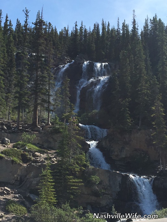
The following morning, we checked out of the hotel and continued up the Icefields Parkway to Jasper. Our first stop–only 6.5km north of the Glacier View Inn/Columbia Icefield Glacier Discovery Center–is Tangle Falls. It is right off the main highway but easily missed. A multi-tiered cascade, Tangle Falls is 114 feet (35 meters) tall. Our stop was quick, but it was the perfect way to start the day.
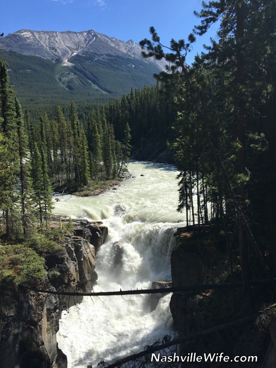
We hopped back in the car and drove about 25 miles (40km) north to Sunwapta Falls.
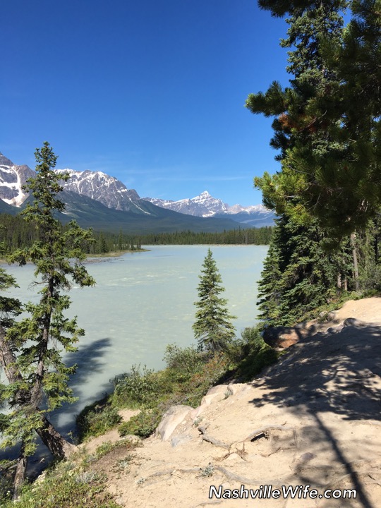
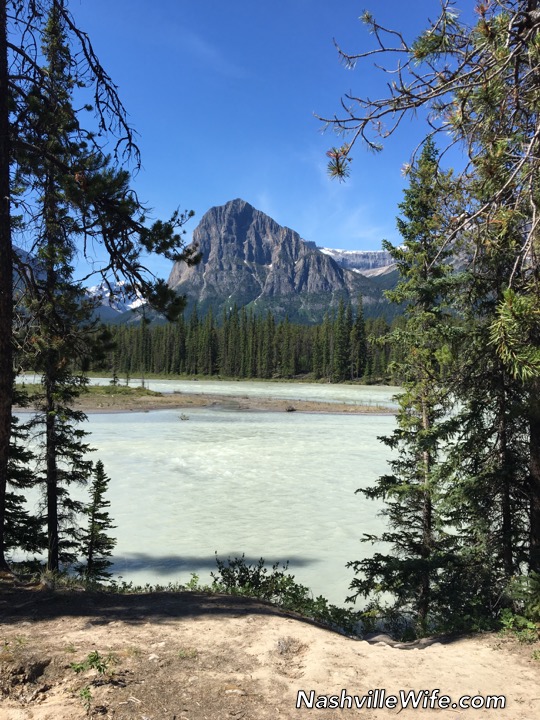
Just a short while up the road, we stopped at a viewpoint of the famous Athabasca River.
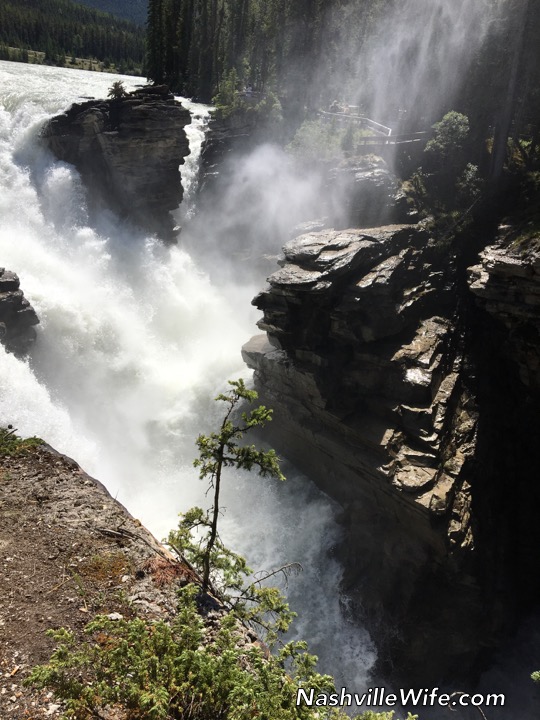
After another short drive, we came to Athabasca Falls, one of the most iconic stops along the Icefields Parkway.
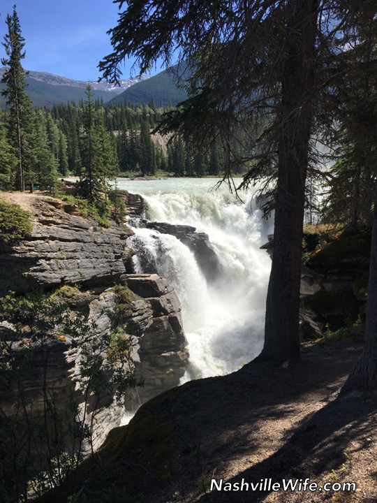
The sheer volume of water that runs over the falls is incredible…approximately 4,000 cubic feet per second! As you can imagine, it is quite loud.
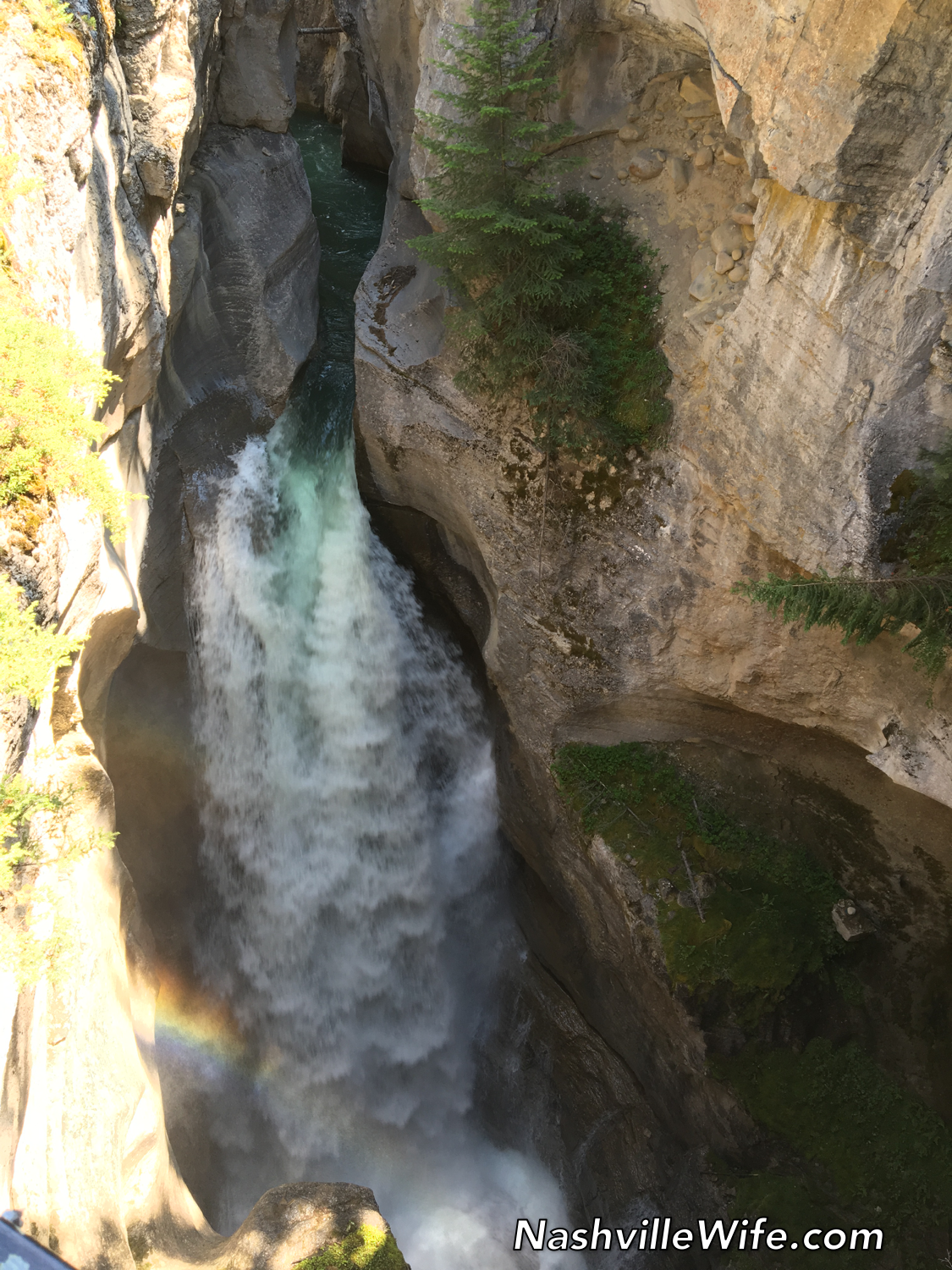
From Athabasca Falls, we drove about 40 minutes (past Jasper Townsite) and stopped at Maligne Canyon, a limestone canyon. We had seen a couple other canyons on our trip (Johnston Canyon and Mistaya Canyon) and they were all beautiful and worth stopping at.
Six bridges cross the narrow gorge of Maligne Canyon, and as you look down, the water is 50m (164 feet) below your feet. Yikes! We were on a time crunch, so we only walked to the first bridge, but someday we hope to return and do the full 7km hike.
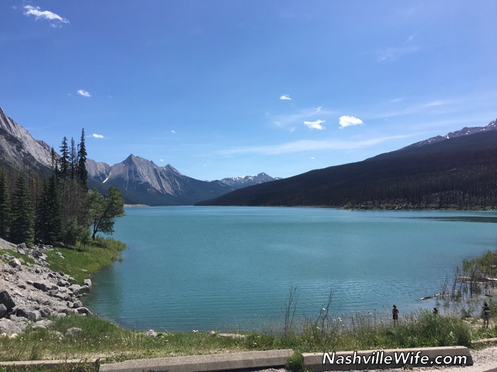
From Maligne Canyon, we continued on down the remote Maligne Lake Road and stopped 20 minutes later at Medicine Lake, perhaps the most unique “lake” in the Rockies. You probably won’t believe me when I tell you that it has holes in the bottom and isn’t a real lake, but allow me to explain.
In summer, runoff from melting glaciers gathers to create what appears to be a lake, but in the fall, the “lake” becomes a muddy flatland with a stream connecting scattered pools of water. Here’s the shocking part: What creates that abrupt change is a process in which the water from the “lake” drains out through the holes in the bottom and empties into an extensive underground cave system that researchers believe to be one of the largest in the world.
Maligne Canyon is actually the next spot where the underground river surfaces. I had to laugh when I read that folks in the mid-1900s made unsuccessful attempts to plug the holes with mattresses, magazines, and other materials in order to attempt to set up a ferry service.
We saw several more sites before the end of the day, but I think that’s enough for now. I’ll pick up where I left off next time.