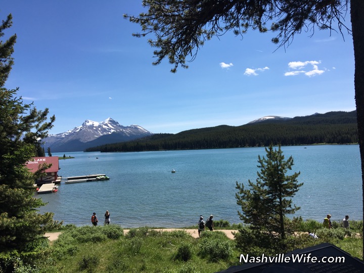
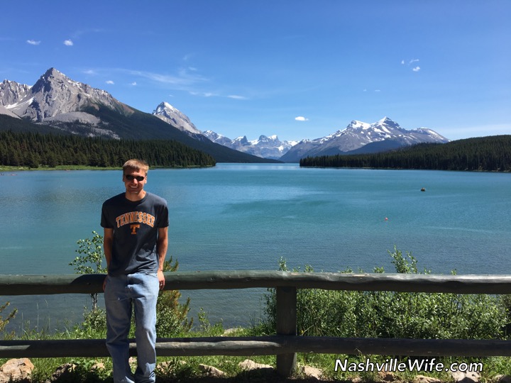
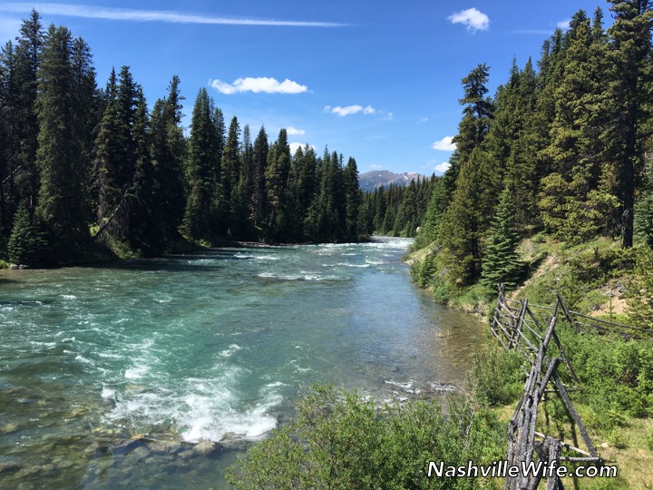
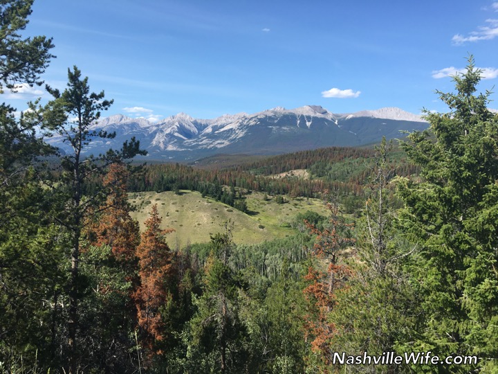
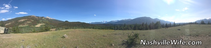
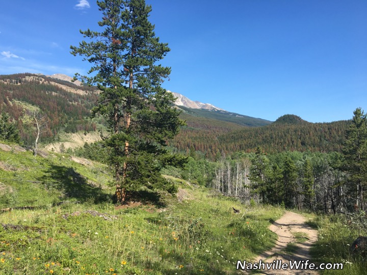
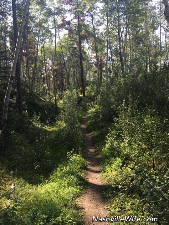
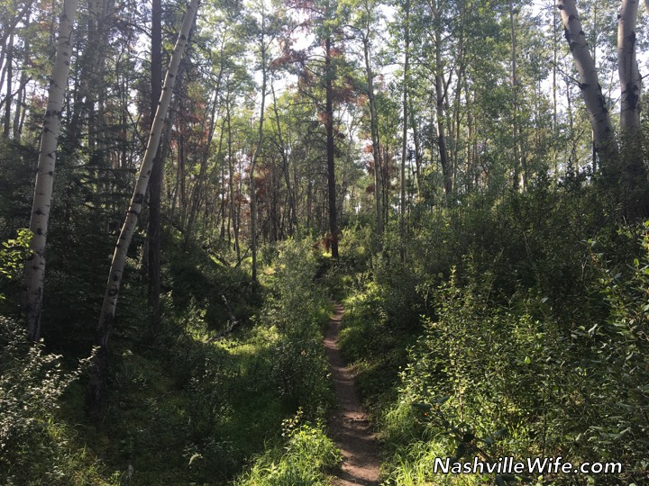
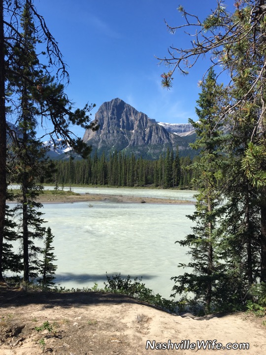
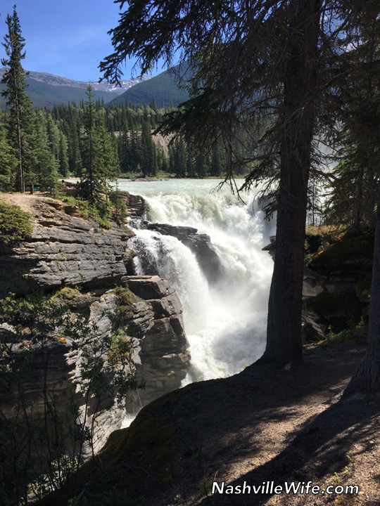
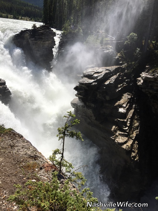
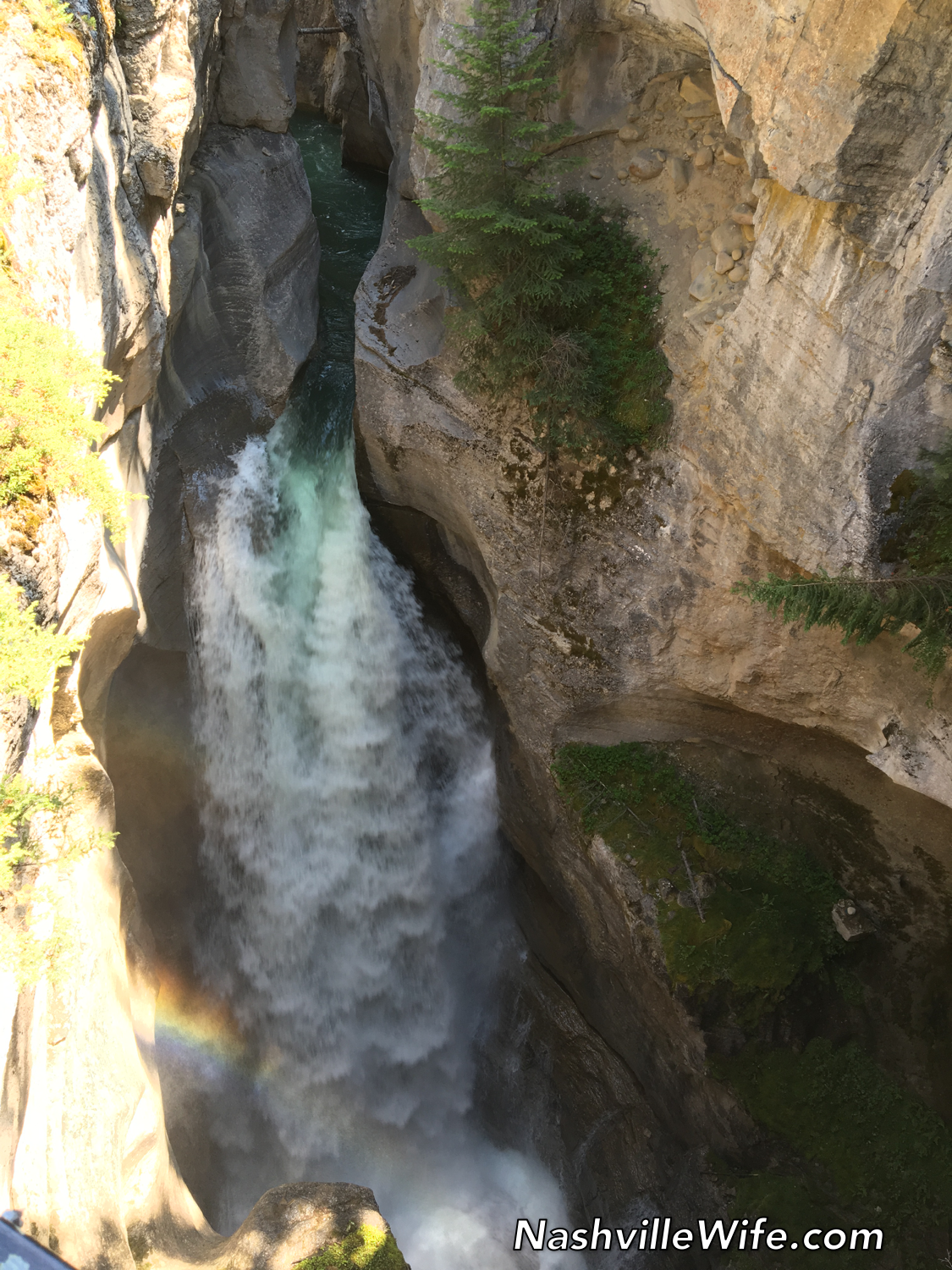
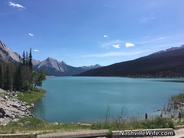
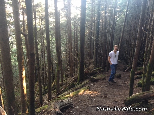
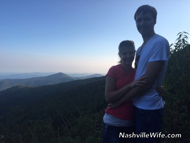
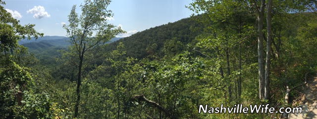
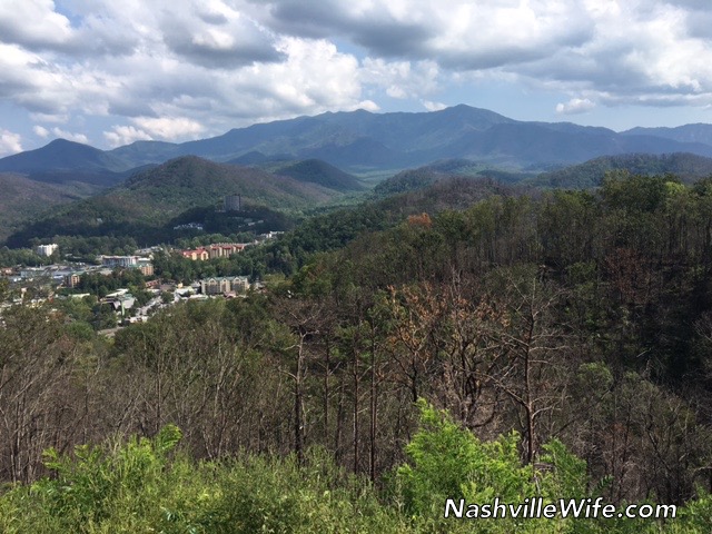
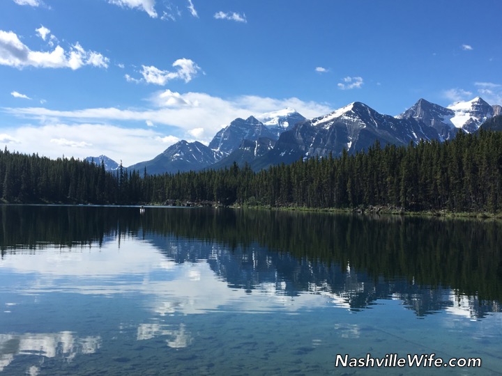
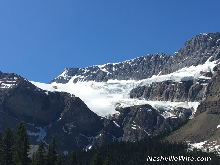
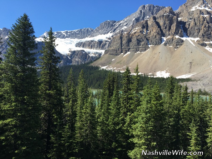
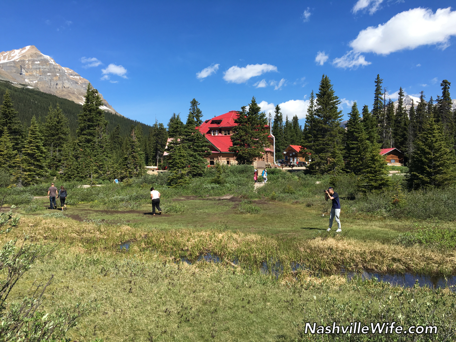
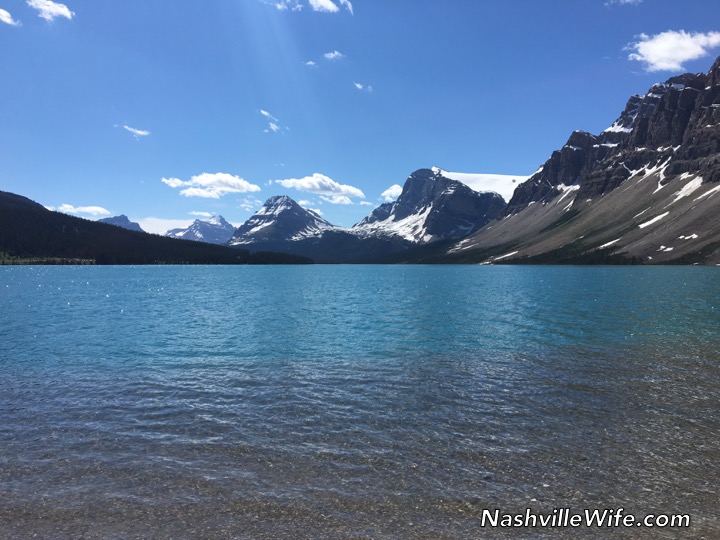
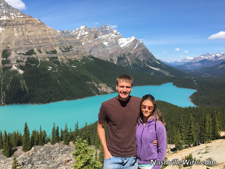
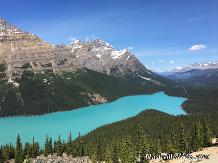
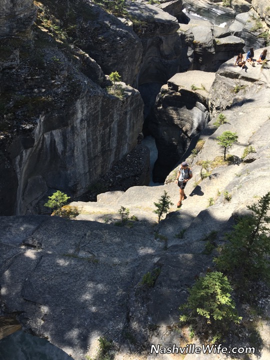
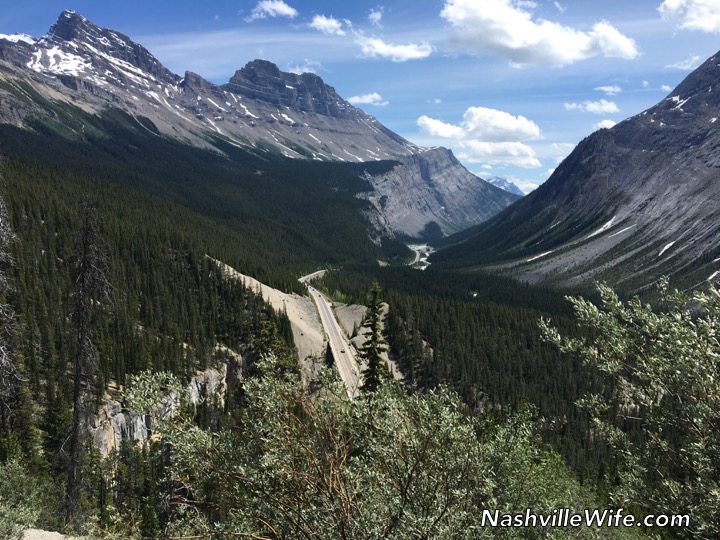
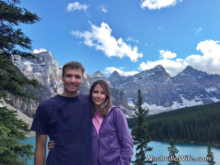
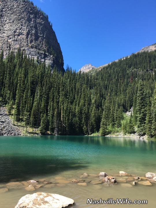
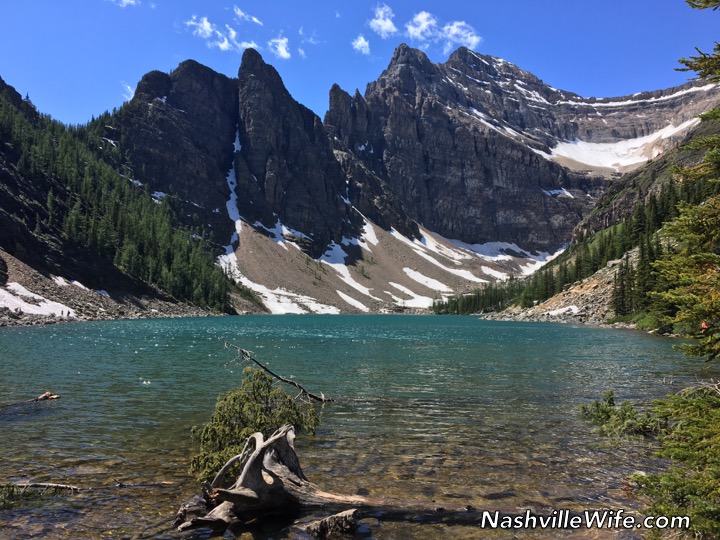
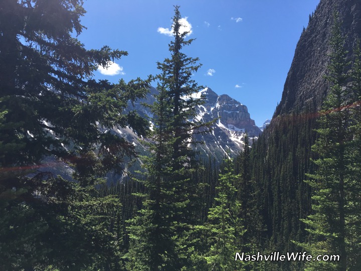
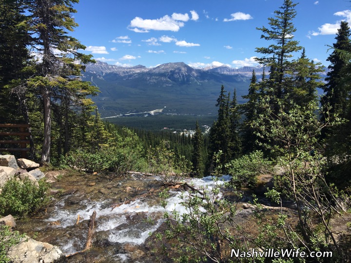
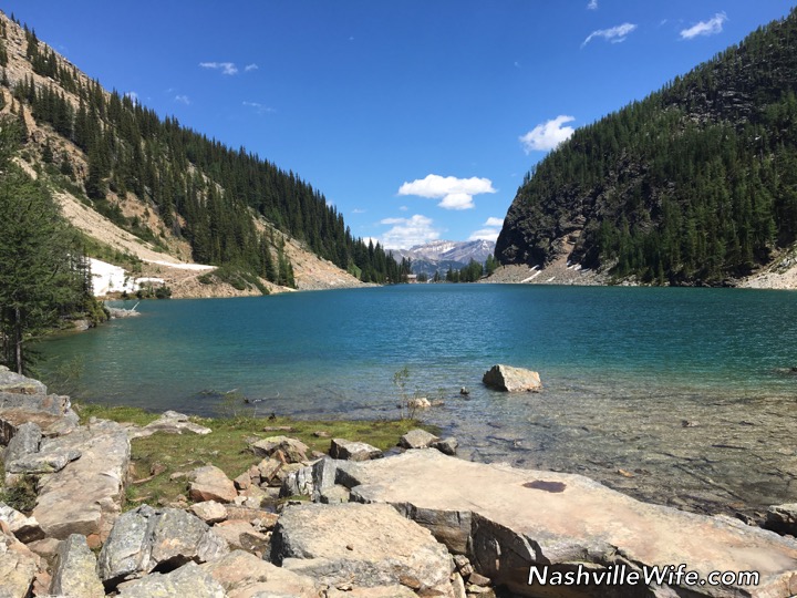
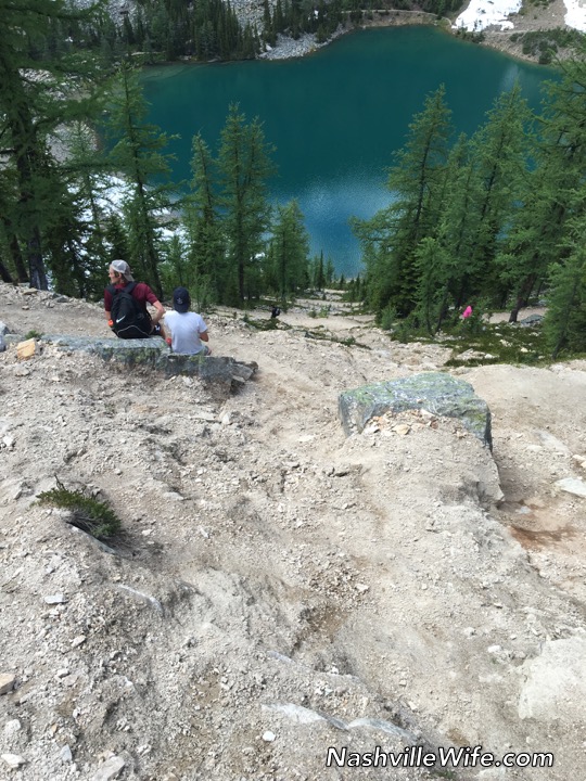
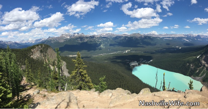
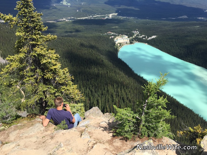
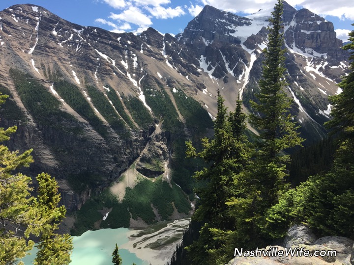
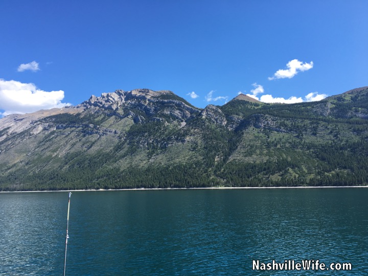
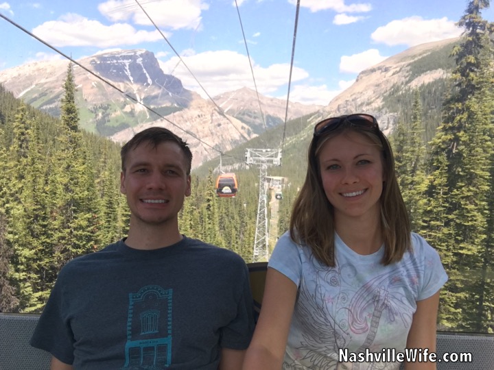
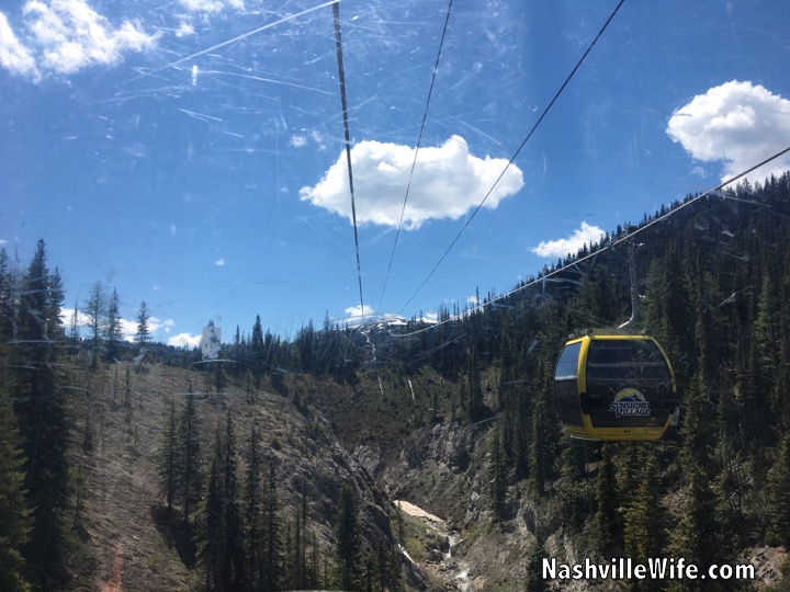
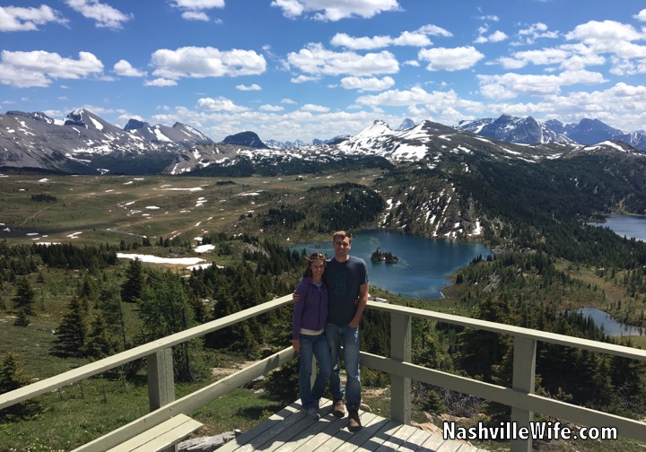
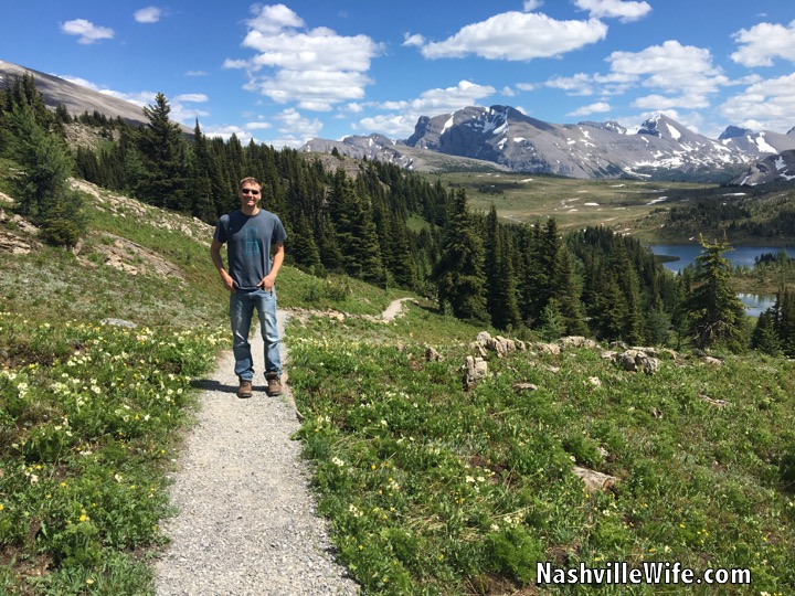
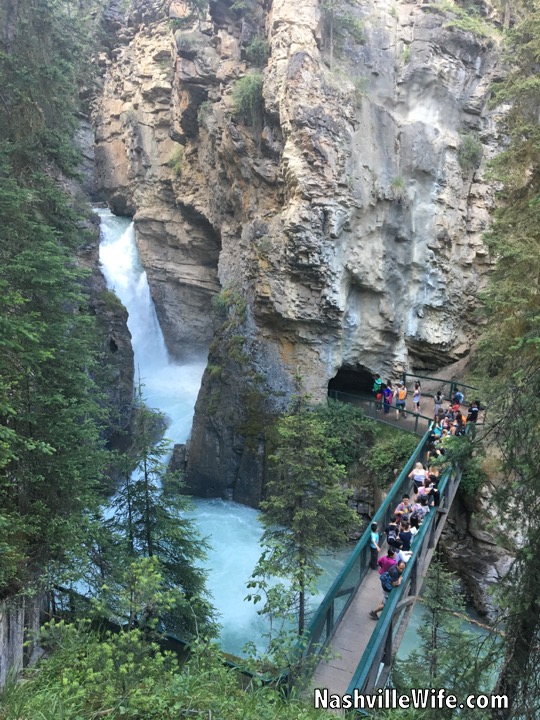
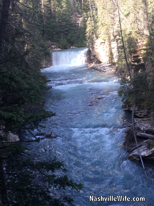
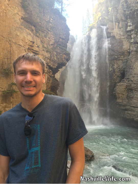
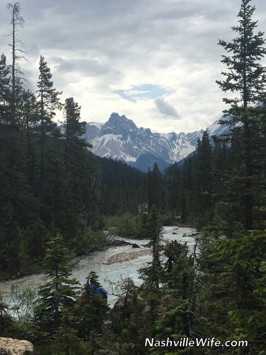
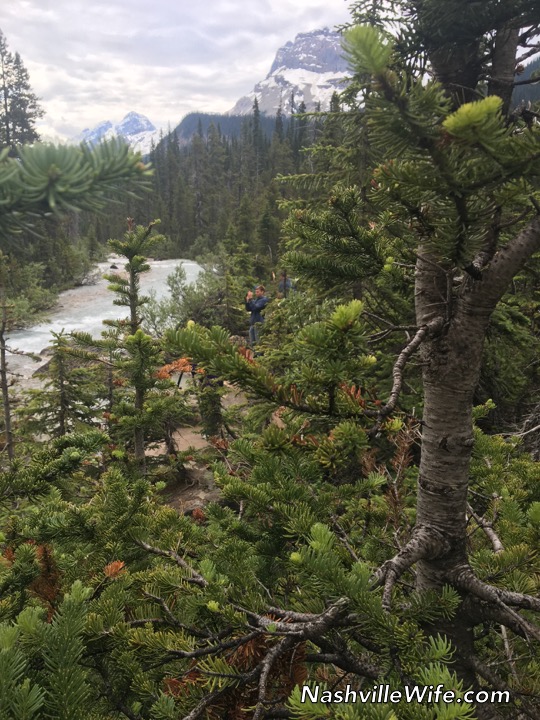
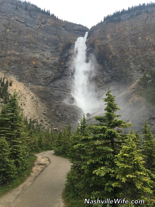
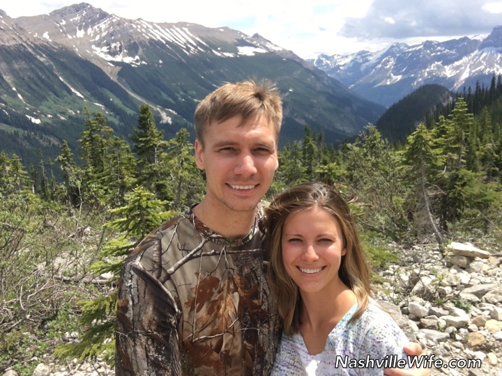
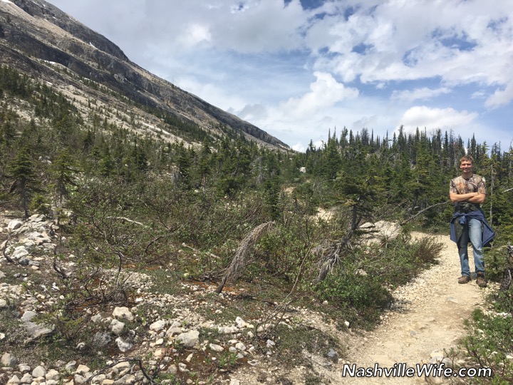
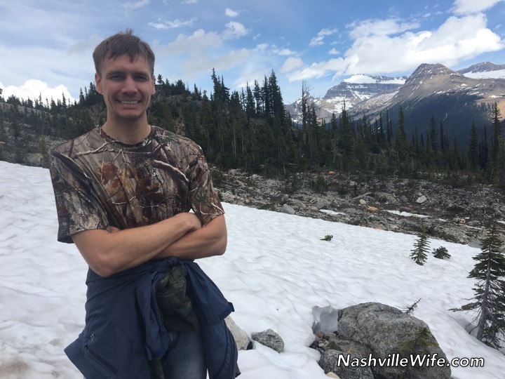
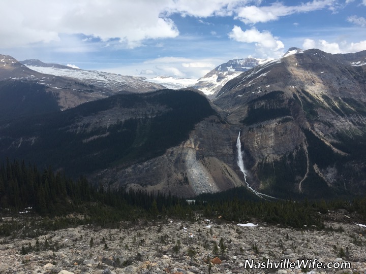
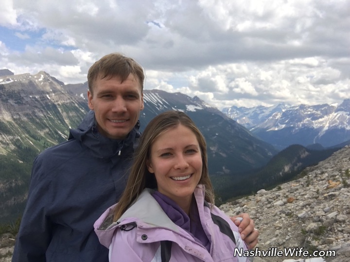
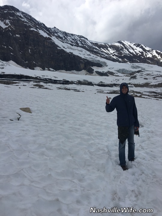
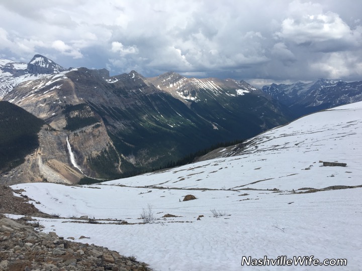
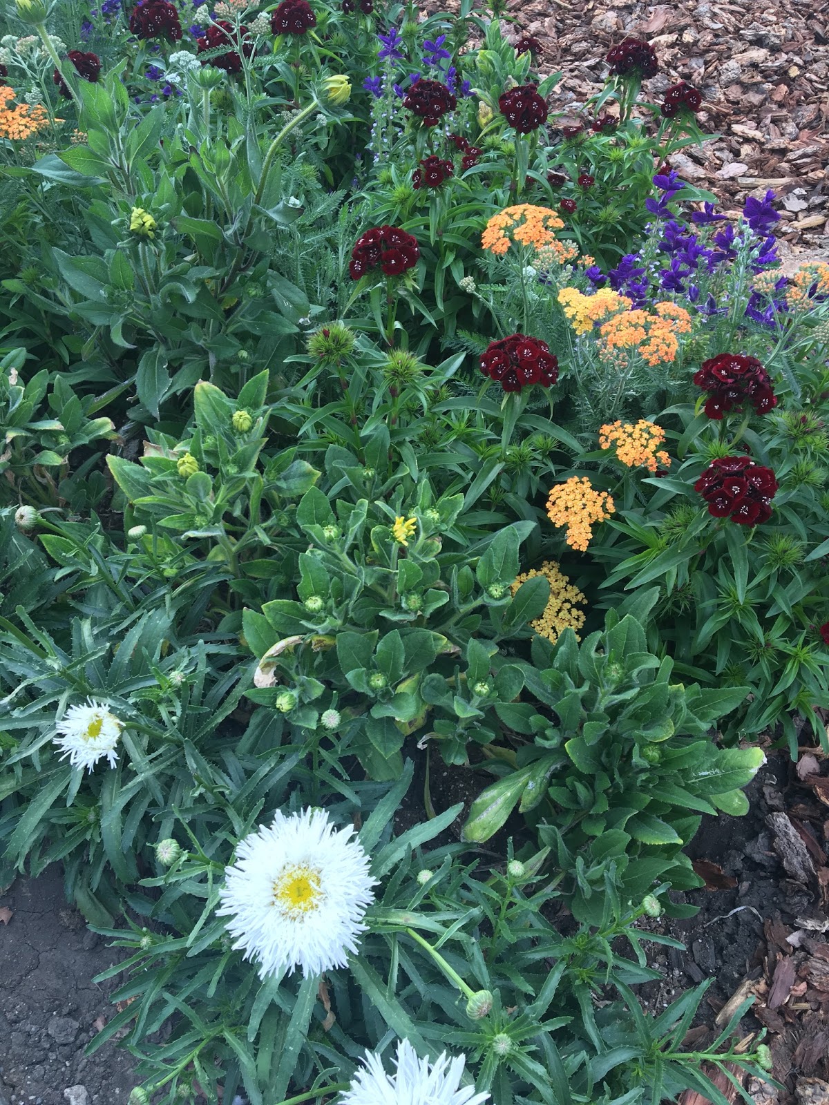
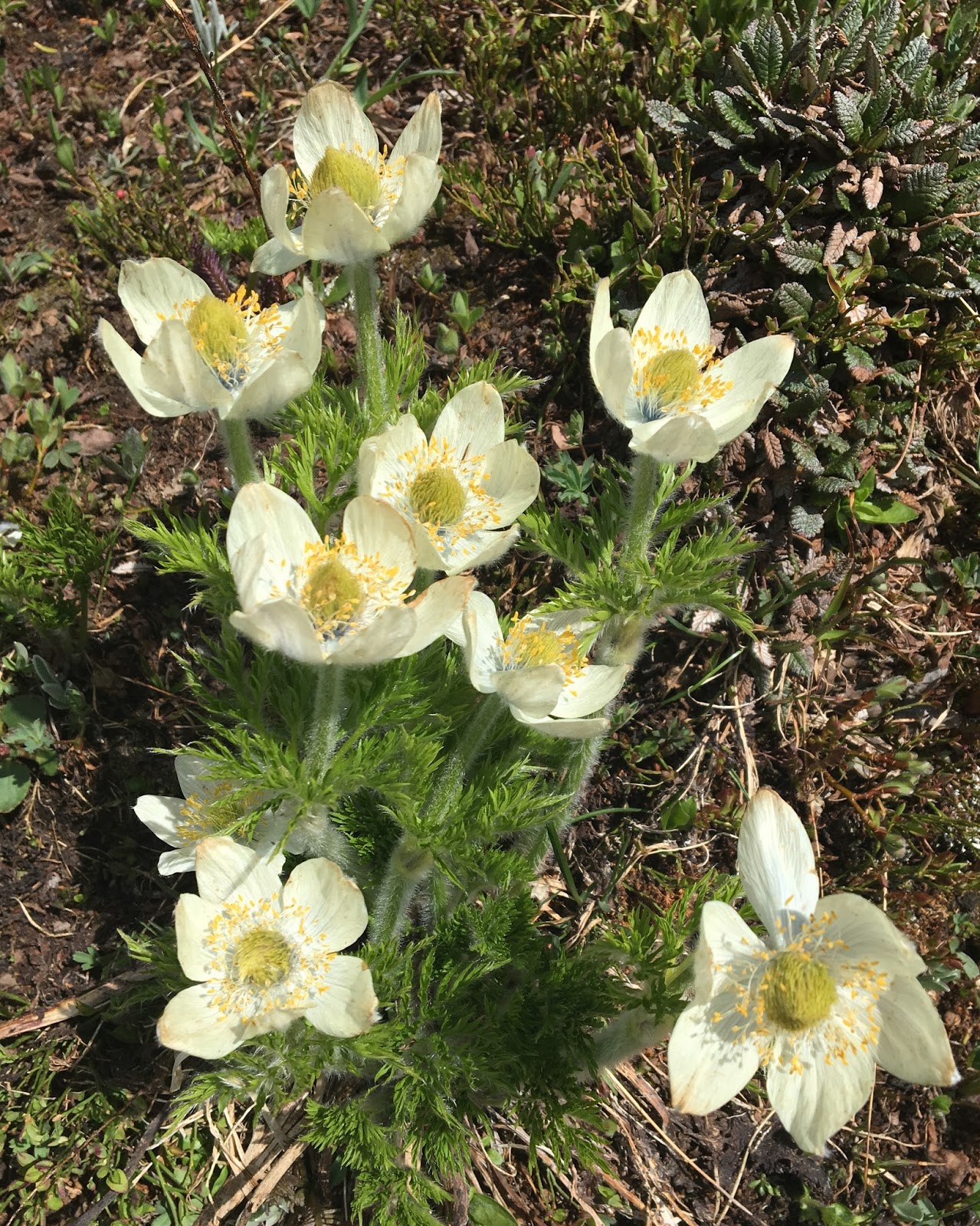
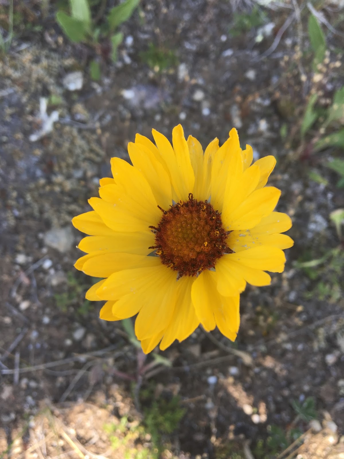
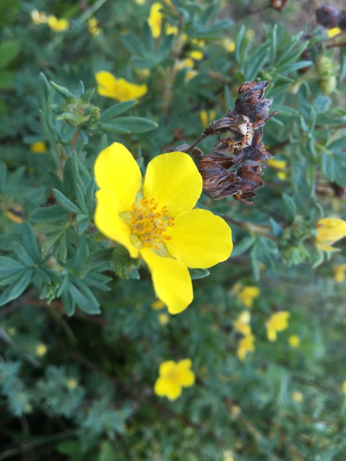
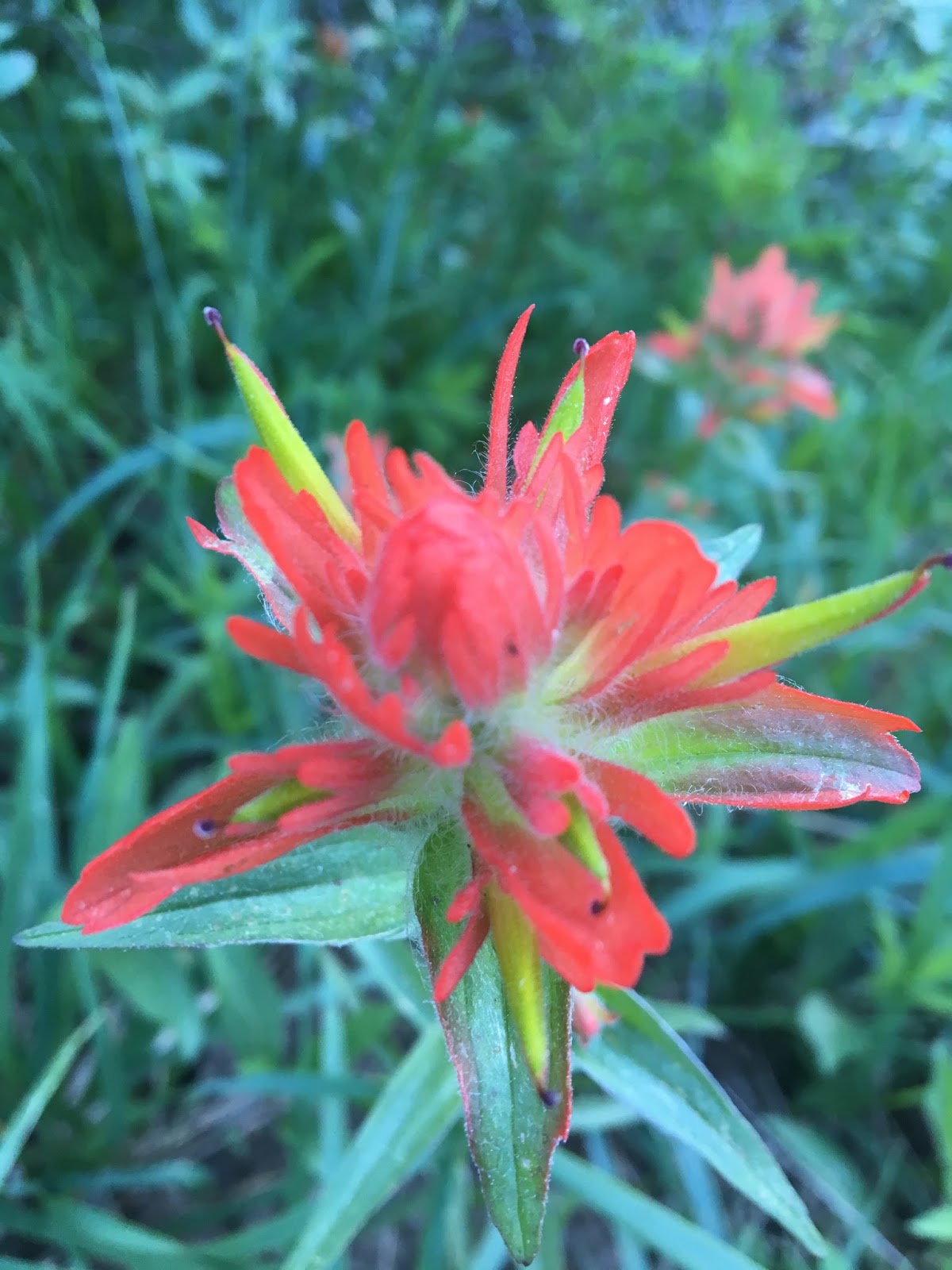
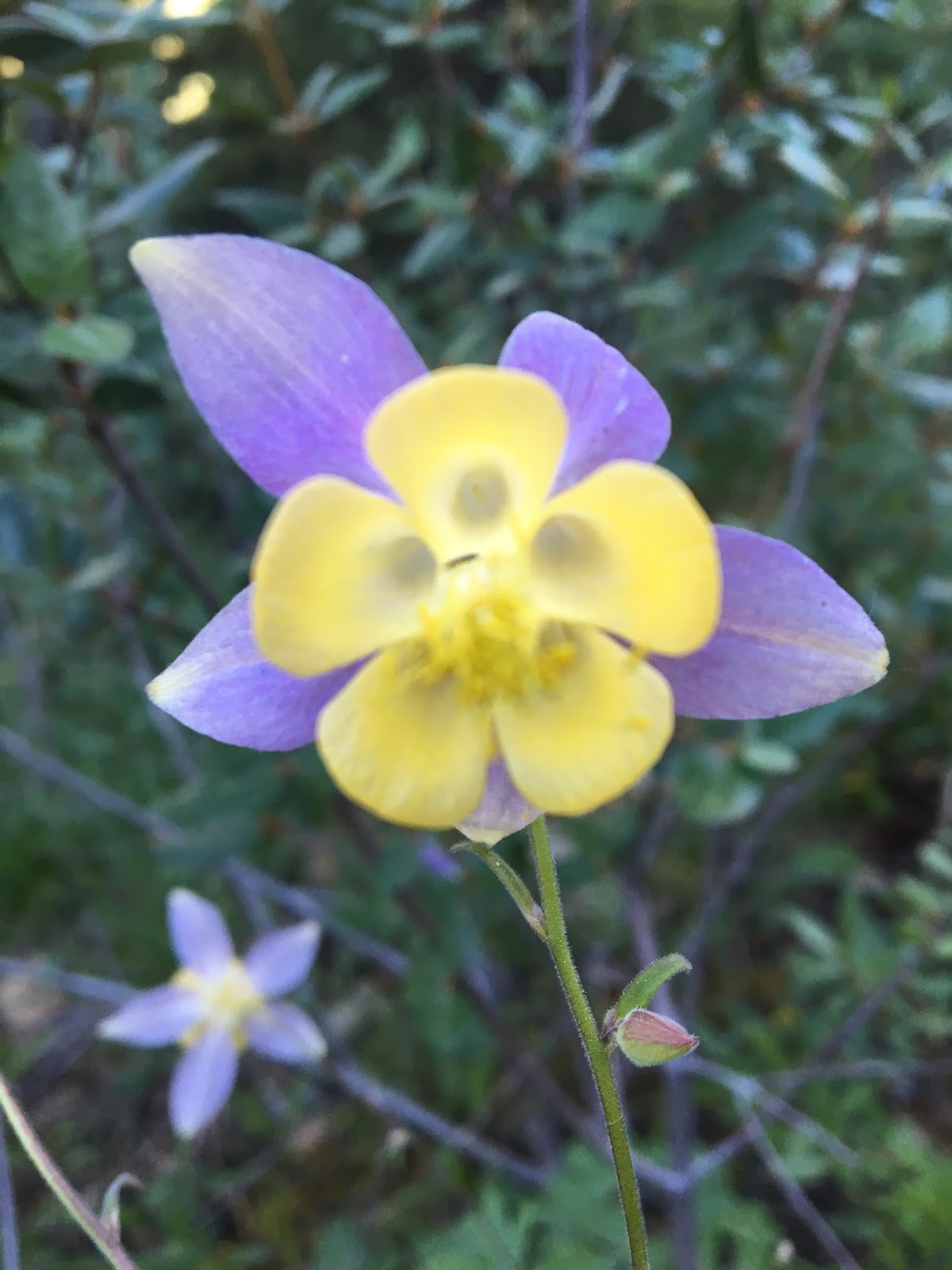
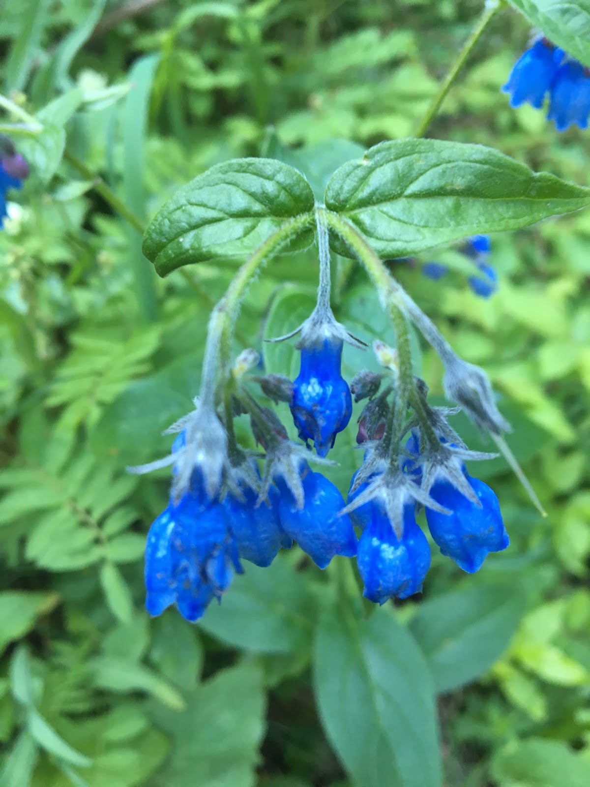
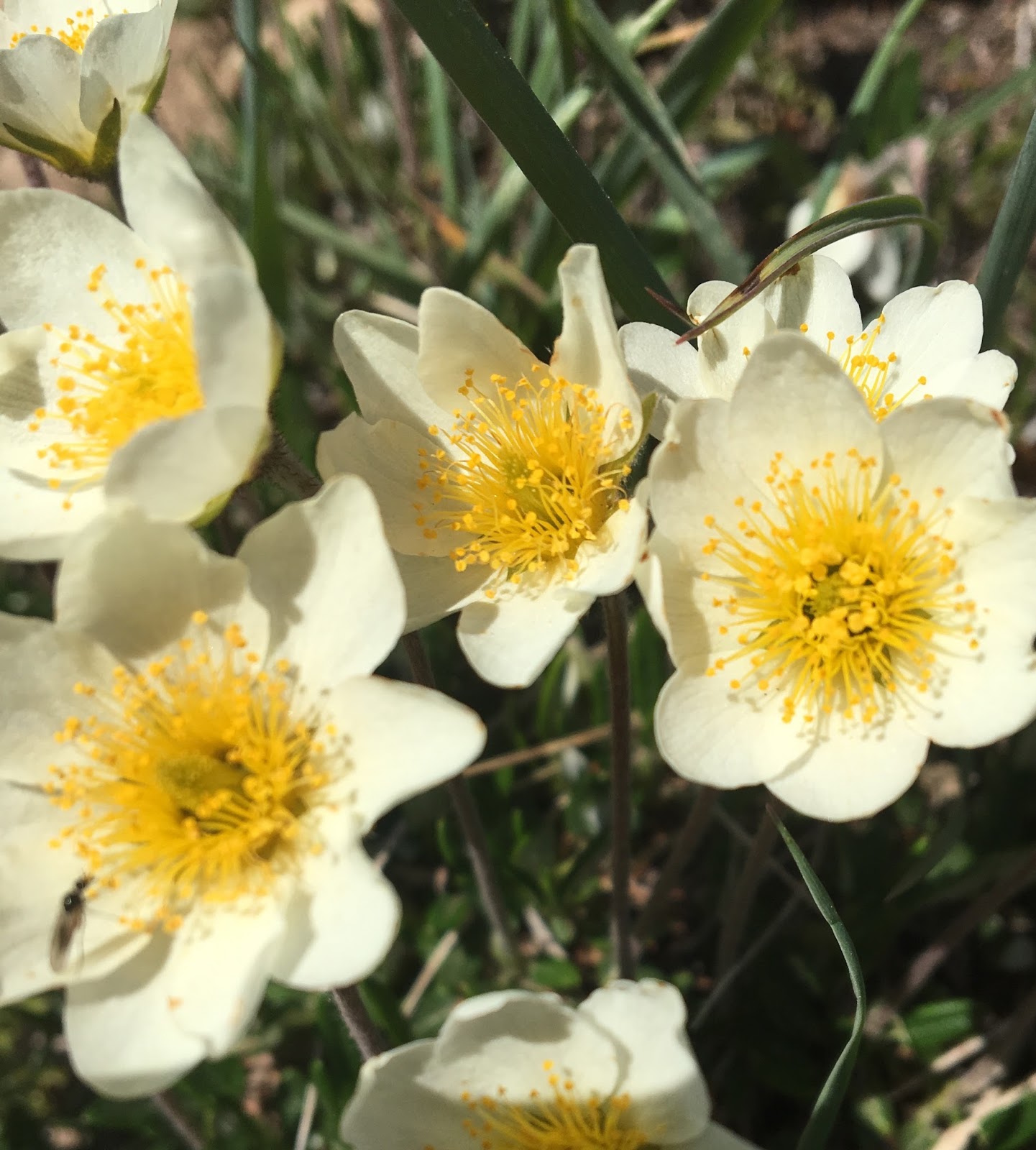
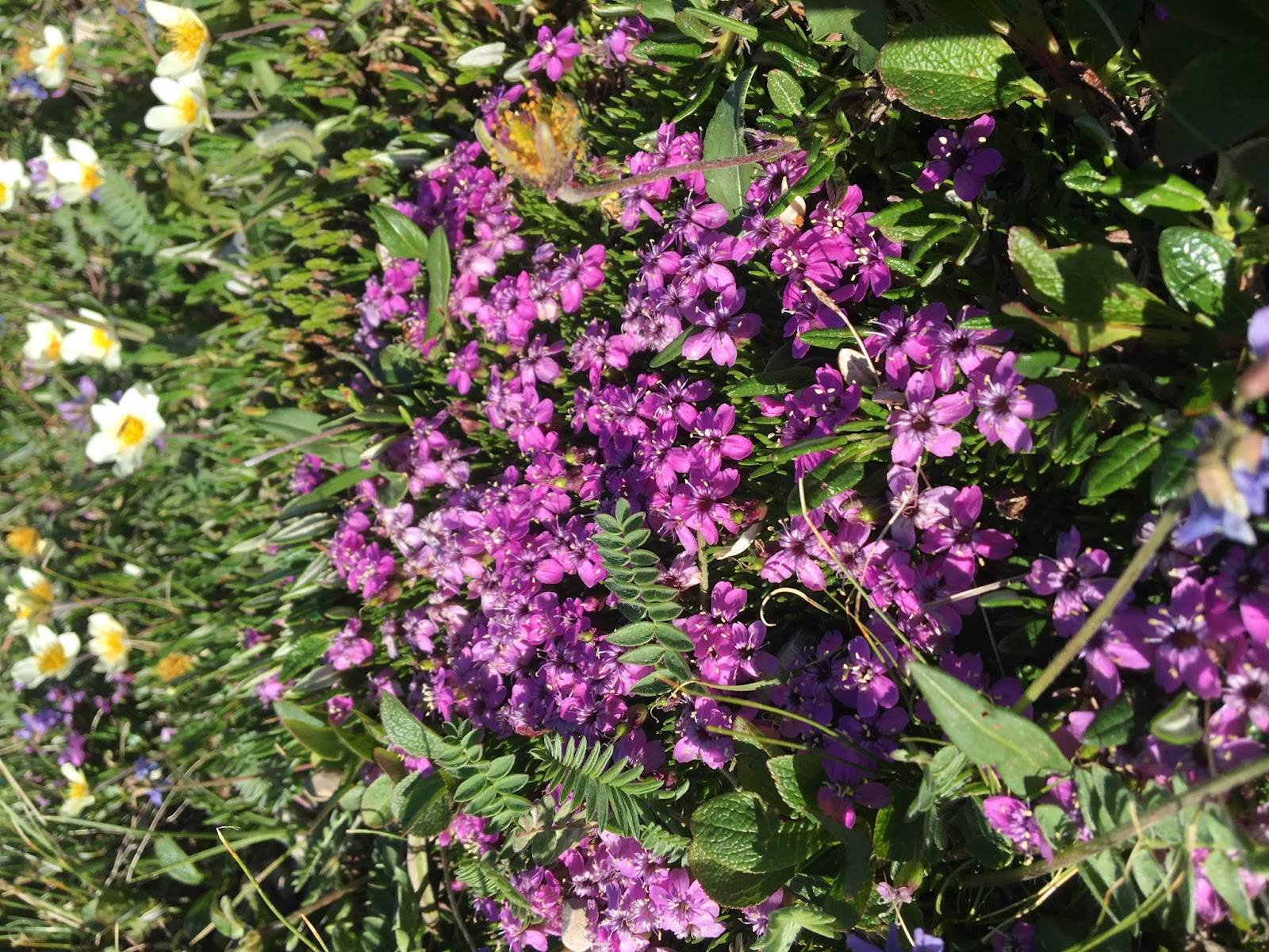
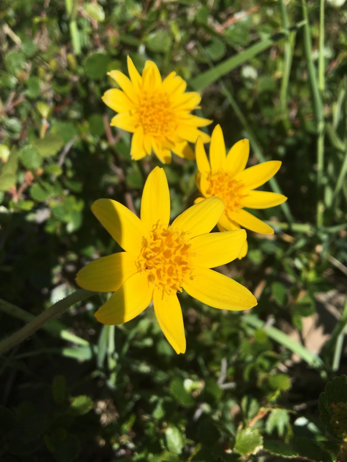
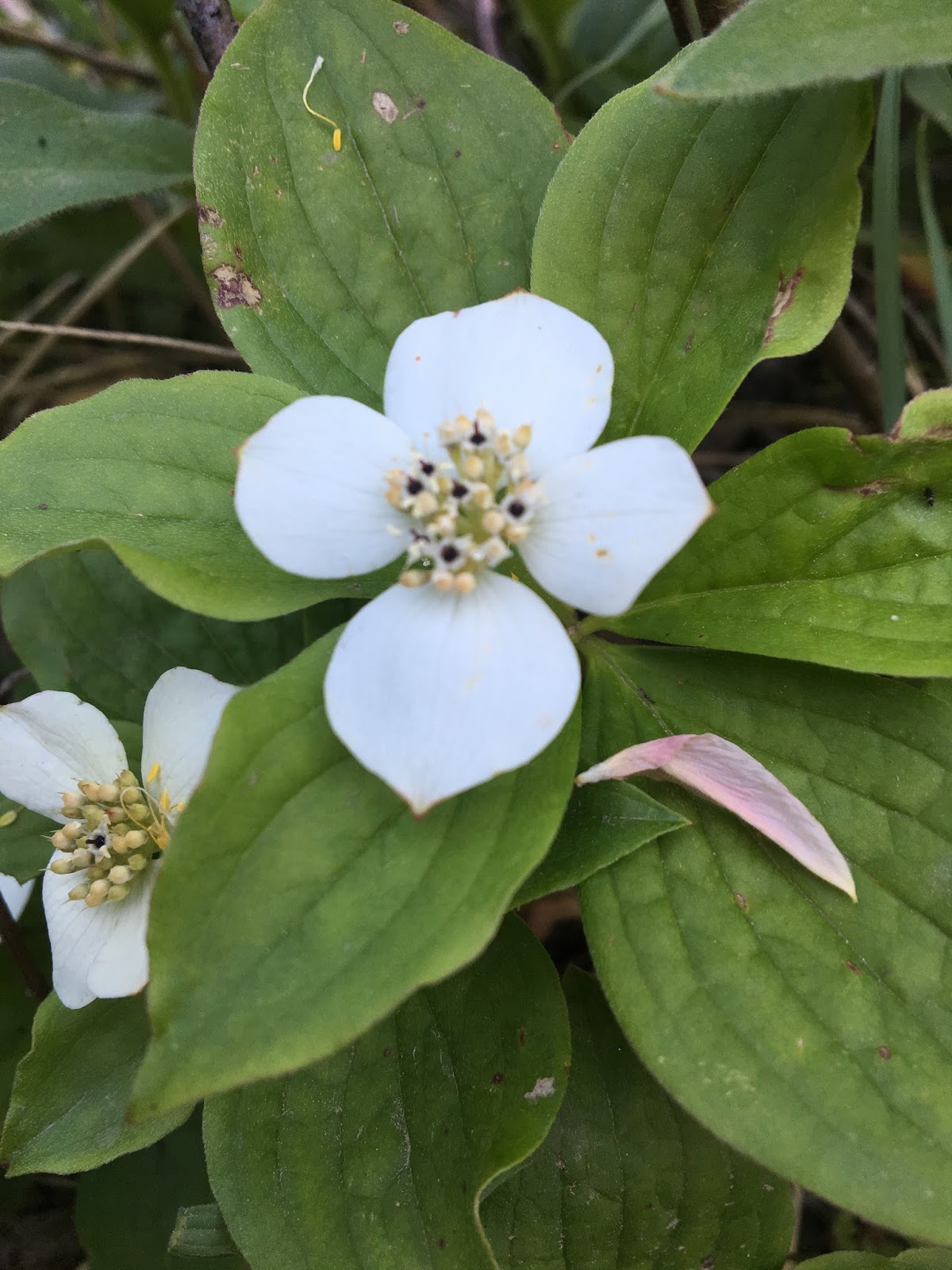
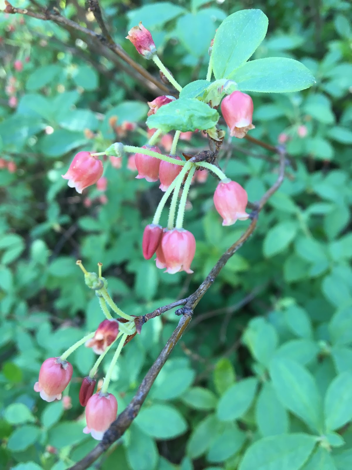
1 |
2 |
3 |
4 |
5 |
6 |
7 |
8 |
9 |
10 |
11 |
12 |
13 |
14 |
Lifestyle Blog | Recipes | Home Decor | Money Saving | DIY Wedding Planning
by 27 Comments
1 |
2 |
3 |
4 |
5 |
6 |
7 |
8 |
9 |
10 |
11 |
12 |
13 |
14 |
by 11 Comments
We spent an hour walking along the lakeside trail and admiring the gorgeous view. Mr. Handsome’s Tennessee shirt earned us a conversation withe a couple from our neck of the woods. They were on their way back from a long road trip to Alaska and happily told us that the scenery in the Canadian Rockies was better than anything else they had seen on their journey.
Although it is very much in the middle of nowhere (no cell service, either), Maligne lake does have a nice cafeteria, where we purchased an iced coffee. Kind of ironic. After all, it would be a major travesty to have to embark on a mountain hike without first getting your coffee fix.
We browsed the small gift shop and saw this hanging decoration. Mr. Handsome is an avid fisherman, so it made us both chuckle.
Before heading back to our car, we snapped some photos for painting inspiration.
The day was quickly getting away from us, but we want to get a good hike in before dinner, so we stopped at Old Fort Point Loop, near Jasper Townsite, and made the 2.5-mile/4km round-trip to the summit. The 360-degree view was wonderful.
The parks service had even hauled a pair of lawn chairs up there.
We were surprised to only see a few other hikers along the way.
After the hike, we snarfed down pizza at a restaurant in Jasper and then headed east to our accommodations, Miette Hot Springs Resort.
It was 10:30pm when we arrived. The sun had just gone down, and Miette Hot Springs was about to close. Much to our dismay, the “hot springs” is just a regular old swimming pool fed by the hot springs. When we found out that they empty it daily and add chlorine, we weren’t too interested in paying to go swimming.
by 21 Comments
The following morning, we checked out of the hotel and continued up the Icefields Parkway to Jasper. Our first stop–only 6.5km north of the Glacier View Inn/Columbia Icefield Glacier Discovery Center–is Tangle Falls. It is right off the main highway but easily missed. A multi-tiered cascade, Tangle Falls is 114 feet (35 meters) tall. Our stop was quick, but it was the perfect way to start the day.
We hopped back in the car and drove about 25 miles (40km) north to Sunwapta Falls.
Just a short while up the road, we stopped at a viewpoint of the famous Athabasca River.
After another short drive, we came to Athabasca Falls, one of the most iconic stops along the Icefields Parkway.
The sheer volume of water that runs over the falls is incredible…approximately 4,000 cubic feet per second! As you can imagine, it is quite loud.
From Athabasca Falls, we drove about 40 minutes (past Jasper Townsite) and stopped at Maligne Canyon, a limestone canyon. We had seen a couple other canyons on our trip (Johnston Canyon and Mistaya Canyon) and they were all beautiful and worth stopping at.
Six bridges cross the narrow gorge of Maligne Canyon, and as you look down, the water is 50m (164 feet) below your feet. Yikes! We were on a time crunch, so we only walked to the first bridge, but someday we hope to return and do the full 7km hike.
From Maligne Canyon, we continued on down the remote Maligne Lake Road and stopped 20 minutes later at Medicine Lake, perhaps the most unique “lake” in the Rockies. You probably won’t believe me when I tell you that it has holes in the bottom and isn’t a real lake, but allow me to explain.
In summer, runoff from melting glaciers gathers to create what appears to be a lake, but in the fall, the “lake” becomes a muddy flatland with a stream connecting scattered pools of water. Here’s the shocking part: What creates that abrupt change is a process in which the water from the “lake” drains out through the holes in the bottom and empties into an extensive underground cave system that researchers believe to be one of the largest in the world.
Maligne Canyon is actually the next spot where the underground river surfaces. I had to laugh when I read that folks in the mid-1900s made unsuccessful attempts to plug the holes with mattresses, magazines, and other materials in order to attempt to set up a ferry service.
We saw several more sites before the end of the day, but I think that’s enough for now. I’ll pick up where I left off next time.
by 9 Comments
After spending all our weekends at home for a couple months, we recently drove out to North Carolina for a wedding. It was a several hour drive, but the gorgeous scenery was well worth it. On our way home, we stopped for two beautiful hikes. The first was in Western North Carolina, about 45 minutes northeast of Asheville. I spent quite a bit of time researching online to find the hikes with the best views, and you know what I discovered? There are tons in that area!We ended up choosing Mt. Mitchell State Park because reviews said the terrain is more similar to Western Canada. (Most of you know that we took a trip to the Canadian Rockies this summer and loved it.)
Of course there are no snowy peaks in North Carolina at this time of year, but it was still about 20 degrees cooler at the summit than it was along the interstate. The one downside is that the 20-plus-mile road leading to the park is narrow and winding.
We drove as far as the road would take us, parked, and then walked five minutes up to the Mt. Mitchell Summit. The view was glorious!
At 6,684 feet elevation, Mt. Mitchell is the highest peak east of the Mississippi River. Apparently the guy after whom the mountain is named lost his life proving that statistic.
We wanted some decent exercise, so we hiked two miles down the mountain on the Commissary Trail (very rocky but not too strenuous). On the way back up, we took the 2-mile Old Mitchell Trail (even rockier and much more strenuous).
The sun was setting quickly, so we had to jog part of it, but of course we still had to stop and take a few photos.
We spent the night at a cheap hotel in Asheville, walked around the shops of Historical Biltmore Village and then drove a couple hours to Gatlinburg to hike the 2.6-mile out-and-back Laurel Falls Trail.
It took about 30 minutes to reach the waterfall and 20 minutes to return. The trail is a decently steep incline, but due to erosion, it is paved (although still very bumpy). The waterfall was beautiful, as were the views along the way.
In downtown Gatlinburg, we stopped for BBQ at Calhoun’s, a Knoxville-based restaurant with nine locations. The ribs were some of the best we had ever tasted. And let me tell you, when your husband is as much of a ribs connoisseur as mine is, that’s saying a lot.
While driving through the area, we saw some of the damage from the November 2016 Gatlinburg fire, but the town has done a fantastic job of restoring and rebuilding.
by 22 Comments
Have y’all been enjoying seeing photos from our trip to the Canadian Rocky Mountains? For those who have missed past post, here are all the links:
Canadian Rockies Day 1
Canadian Rockies Day 2
Canadian Rockies Day 3
Canadian Rockies Day 4
Ā Ā Ā Lake Louise
Ā Ā Ā Moraine LakeĀ
Canadian Rockies Day 5
Ā Ā Ā Icefields Parkway Part 1
And now for my next post, our tour of the Athabasca Glacier. This was certainly one of the highlights of our trip.
After spending the day driving along the Icefields Parkway, we stopped at the Glacier View Inn for the night. We dropped our bags off in our room; grabbed our winter jackets,
hats, and gloves; and embarked on our glacier tour. A coach bus took us
partway up the mountain to a transfer station, where we boarded a giant
Ice Explorer, which took us up onto the Athabasca glacier.
The Ice Explorer is a very unique vehicle that is able to climb up extremely steep slopes while gripping the ice. Aside from the one used by the United
States Military up in Alaska, they are all currently being used on the
Athabasca Glacier.
From
the hotel, the glacier looks very small, but once you’re up there, you realize just how massive it really is. As deep as the Eiffel Tower is tall, the Athabasca Glacier is approximately 6 km (3.7 miles) long and is receding at a rate of about 5 meters per year.
On the way up, we passed pine trees that are 300-700 years old. The growing season is only 60-90 days, so despite their age, the trees are quite skinny. They aren’t
very tall, either.
When the Ice Explorer completed its climb up the glacier, we were able to hope out and walk around. It was crazy to think just how thick the ice was below us.
Although the park officials were unable to legally prevent visitors from walking outside of the designated area, we were not about to wander off after hearing about the danger of falling into a crevasse (a deep, narrow opening in the ice).
Although it was cold, we took our gloves off and took the opportunity to try some fresh glacier water.
After the glacier excursion, we spent a few minutes on the Glacier Skywalk, a transparent platform jutting out from the edge of a mountain. It was a bit disappointing, as it didn’t actually look out over the glacier but over a valley a few miles away from the glacier. If you’re afraid of heights, you may not enjoy the skywalk, as it hangs 30 meters (98 feet) in mid air.
Check out this video that we made on top of the the glacier:
by 13 Comments
We hopped back in the car and continued driving, passing the Hector Lake viewpoint after 10 minutes but deciding not to stop. About 10 minutes past that was a pull-off that provided a fabulous view of Crowfoot Glacier. Naturally, we snapped a picture from both sides of the road.
Another short drive (about 8 minutes) and we arrived at Simpson’s Num-Ti-Jah Lodge. My family and I stayed there when I was about eight years old, so I have great memories of that place.
The lodge sits on the rocky shores of beautiful Bow Lake, making it a popular stop for tourists. When I visited as a child, it was an especially chilly summer, and the surrounding mountains were still covered in ice and snow, like a winter wonderland. I remember it vividly.
Our next stop was Peyto Lake (another 10 minutes up the road). Named after turn-of-the-century guide Bill Peyto, Peyto Lake is known as “the bluest lake in the Rockies.”
Also in the same location is Bow Summit, the highest point on the Icefields Parkway (2,135 meters/7,000 feet elevation).
After a 25 minute drive, we stopped at Mistaya Canyon. We walked 0.5 miles down a steep incline and arrived at this spot.
If you look closely, you’ll see the powerful current rushing through the canyon. Truly an incredible sight! There were additional trails we could have hiked, but we were on a tight
schedule, as we had to make it to our glacier tour by 4:00pm. We made the grueling trek up the steep hill and back to our car.
A short five minute drive along the main road brought us to Saskatchewan River Crossing, the first oasis with gas and food that we had hit since Lake Louise. Still no cell reception, though.
Twenty-five minutes later, we made our way up the “Big Hill” and pulled over on the side of the road for a breathtaking view of the North Saskatchewan Valley.
By that point, we were only 10 minutes away from our destination for the night, a large building that houses the Glacier View Inn and the Columbia Icefield Glacier Discovery Centre.
I had called the hotel a few weeks before and booked their very last room that week. What a blessing! It is the only hotel and restaurant for many miles and was the perfect place to stop. But before calling it a night, we still had to take our glacier tour, my most anticipated stop on our entire trip. This has been a long post already, so I’ll have to wait until next time to tell you all about our excursion on the Athabasca Glacier.
by 17 Comments
A few days, I shared photos and details from our visit to Lake Louise on our fourth day in the Canadian Rocky Mountains. Although it was late in the day when we finished our 6.5-hour hike, we were determined to visit Moraine Lake before leaving the area.
It was about 6:00pm by the time we started the 30-minute drive up the narrow, windy road to Moraine Lake. There was no cell service and no turnarounds. When we were about one mile away from the lake, traffic came to a stand still.
We had spent our first few days in areas where there were not many tourists, so this was a shock to us. But Moraine Lake is arguably the most iconic spot in the Rocky Mountains (both in the U.S. and Canada and is often used as the “postcard picture” of the Rockies. So considering we were in Banff over what was expected to be one of the busiest weekends in years, it actually wasn’t all that surprising.
We sat in traffic for another 30 minutes before we were able to secure a spot in the tiny parking lot. There are
trails to hike at Moraine, but we elected to just enjoy the
breathtaking view from on top of the giant rock pile next to the parking
lot. It was one of Mr. Handsome’s favorite views, and after we returned
home he painted a beautiful picture of it.
That evening, we stayed at a beautiful cabin at Storm Mountain Lodge.
by 12 Comments
One of the unique things about Lake Louise, aside from the beautiful blue color of the water, is that it offers two hikes to historic teahouses. We were hoping to do the 8.4-mile Plain of Six Glaciers
Teahouse Hike (teahouse built in 1927), but we heard from other tourists that the snow up on top of the glacier was quite deep, so we chose the Lake Agnes Teahouse Hike (a newer teahouse built to replace one built in 1905).
The first half hour of the hike was a steep incline, and the next half hour was steep switchbacks. We arrived at a medium-sized lake that can’t even be seen from the start of the trail. We thought that was pretty incredible, but we were in for an even better surprise!
About 20 minutes further, and we made it up to the teahouse. The teahouse itself is a small, wooden structure, but it sits on a lake about 10 times as large as the first!
The views were splendid!
Both Lake Louise teahouses sit on top of mountains, so they are inaccessible by road and rely on horses and helicopters to bring supplies.
The teahouse was quite busy with hikers enjoying refreshments before going back down the mountain. We took a short break and then decided to
leave the crowds behind and continue on the Big Beehive trail. The trail took us all the way around the lake and through a large patch of snow. Here is the view from the other side of the lake:
From there, we began the steepest, most harrowing trek of our entire trip, as we snaked up a rocky slope. Looking down was quite frightening! I had a few freak-out moments when I almost lost my balance.
It was rough, but once again, the view was totally worth it. There was hardly anyone up at the top, and we could see for miles.
We were directly above Lake Louise and the chateau. The people canoeing on the lake looked like ants.
I nearly had a heart attack as Mr. Handsome sat near the edge to take a picture.
But then I saw another man go even further (while leaning out over the drop-off) and was grateful that my husband wasn’t crazy enough to follow suit. The man’s wife was watching him do this, and she just shook her head and said, “Sometimes I wonder how he’s still alive.”
We sat up there for about 30 minutes, enjoying the views. The air was fresh, and the stillness brought a peacefulness unlike any I had ever experienced in nature.
By the time we made it back to our car, we had hiked 8.6 miles/13.8km in 6.5 hours and gained an elevation of 1,770 feet/540 meters.
We were exhausted, but I still had to show Mr. Handsome beautiful Moraine Lake before we left the area. I’ll share those photos in another post.
by 28 Comments
If you’re like me, you’re probably wondering how on Earth it can be Wednesday already. Where has the week gone?I’m thrilled to hear that you have been enjoying my Rocky Mountain posts. If you missed them, click here to view Day 1 and here to view Day 2.
On Day 3, we woke up very sore and tired, following our intense hike up the Iceline Trail. One thing I forgot to mention on my post about Day 2 was Emerald Lake, another beautiful spot in Yoho National Park. We didn’t have time to visit after our long hike, but if you’re in the area, I highly recommend it. The access road is located just west of the town of Field, British Columbia.
Now for Day 3…
We “slept in” until 7:00 and spent a relaxing morning on a group fishing charter on Lake Minnewanka, located about 15 minutes northeast of Banff Townsite.
As you know, Mr. Handsome is a fishing enthusiast, so he was eager to get a pole in the water.
Most of the fish species were catch and release only, but determining which was which didn’t turn out to be an issue. We didn’t catch a thing.
Canada is celebrating its 150th anniversary with free park admission, so 2017 is projected to be one of the busiest years on record in Banff. We also chose one of the busiest weekends of the year, as we visited over Canada Day. And it had rained the day before. So the fish had many reasons to stay far away from our hooks.
The scenery surrounding Lake Minnewanka made up for the lack of fish. It is among the most well-known fishing spots in Canada, so there was a decent amount of lake traffic, but our guide was able to find some secluded spots to fish. Mr. Handsome says it was by far the most beautiful place he has ever fished.
Lake Minnewanka is a glacial lake that is 142 meters/466 feet deep, so the water is cold. If we were to fall in, the guide advised us to keep our mouths closed to prevent us from swallowing the frigid water and going into shock. Now that’s a comforting thought.
After our fishing excursion, we drove 25 minutes southwest to Sunshine Village, a ski resort that doubles as a summer tourist attraction. I made some delicious peanut butter and jelly sandwiches, and we headed to the gondola. The ride was about 20 minutes long, and although our gondola could have fit eight people, we had it all to ourselves.
I grew up downhill skiing, so I felt right at home on the mountain. Sunshine brands themselves as a family-friendly ski resort, although they have two runs (Wild West and Delirium Dive) that are among the most extreme ski hills in the world.
At a 55-degree gradient, Delirium Dive is only open to guests with an avalanche pack, a beacon, and a shovel. I’ve done my fair share of black diamond hills, but I can say with certainty that I would never venture down Delirium Dive.
The gondola starts at an elevation of 1,660 meters/5,440 feet and lets off at 2,164 meters/7,100 feet. After hopping off the gondola, we walked over to the Standish Chairlift, which shuttled us up to an even higher elevation (2,400 meters/7,875 feet). At that point, we were on the Continental Divide.
From the top of the Continental Divide (also known as the Great Divide) rain or melting snow either flows west toward the Pacific Ocean or east toward the Atlantic Ocean.
The view was other-worldly. It truly felt like we had stepped into a fairy tale.
The mountains seemed to go on forever in every direction. We were shocked that there were only a small number of tourists on top of Sunshine. Folks just don’t know what they’re missing!
Here’s a video we made from the lookout point:
After taking in the spectacular views, we hiked down to the lake and back to the base of the chairlift. The longer trails were closed due to grizzly bear threat and snow, so we only walked 3 km/2 miles through Sunshine Meadows. Seeing patches of snow next to beautiful summer wildflowers was a strange juxtaposition.
We finished off our jam-packed day with a visit to iconic Johnston Falls, located halfway between Lake Louise and Banff along Bow Valley Parkway. Even at 6pm, the path to the falls was packed, but it was still unique to walk along the inside of a canyon with a rushing river below.
After we reached the first waterfall, the number of people dropped by quite a bit.
We stood in line to walk through a small cave to the base of the falls (had to keep our cameras away from the spray) and then kept trucking along.
The hike was only 3 km/2 miles total, but the elevation increased steadily the entire way there.
by 27 Comments
So what are the Spiral Tunnels? Well in 1884, the Canadian Pacific Railway built the segment of track known as the Big Hill. They were in a hurry to complete their route and crowd out competition from northwest U.S. railways, so they created a section with a 4.5% grade, which was very dangerous and resulted in frequent crashes. And during the construction of the track, an average of one crew member died each week. Imagine how secluded it would have felt working in the Rockies 130 years ago!
In 1909, engineers replaced the treacherous section with a new track that included two spiral tunnels to help trains keep their speed in check.
This is a terrible picture, but the orange circles show each opening of the lower spiral tunnel. When a train comes through, you can see the front of the train come out the exit while the back of the train is still going through the entrance.
After our stop at the tunnel, we drove up the winding Yoho Valley Road (closed October through June for use as a cross-country ski route) to Takakkaw Falls.
We walked up a short path to the base of the falls, taking pictures along the way. I attempted to be artistic and snap a photo of Mr. Handsome taking a photo.
The waterfall is 300 meters (nearly 1,000 feet) at its highest point.
As we approached the falls, the air became noticeably colder, and we began to feel the spray.
We ate a fancy picnic lunch (peanut butter and jelly, anyone?) in the parking lot and then decided to be wild and crazy and embark on a long hike along the iconic Iceline Trail. We grabbed water bottles, snacks, raincoats, and sweatshirts and headed out.
Mr. Handsome carried bear spray from our bed and breakfast hosts on his belt. The park rangers have had a lot of trouble with bears this year, and a man was attached–but thankfully escaped–by a grizzly while were were there.
The bear spray was nearly expired, so we tested it before starting the hike. Boy was it a powerful spray! I sprayed it into the woods and walked away, but my nose still burned a bit. Mr. Handsome, on the other hand, didn’t smell a thing.
The first hour of the trek was steep switchbacks up the side of the mountain. When we finally reached the treeline, we were relieved. Time for a photo with our $7 Amazon Selfie Stick!
Every direction provided breathtaking views. There were even some wildflowers growing along the trail.
The next hour was switchbacks along a rocky path. We had to hop over some mountain streams that crossed the trail. The temperature, which had started out at 80F, began to drop to the high 60s, and we started seeing patches of snow.
By that time, we had climbed higher than the Takakkaw waterfall, located across the valley. You can see it in this picture.
We were glad to have our raincoats when it started drizzling!
By the third hour, we were trudging through waist-deep snow. If we walked carefully, we could stay on top of it, but every once in a while, our feet sunk into deep holes, often with rocky streams below. The rain picked up a bit, and the temperature was around 55F, but we were still sweating, as we continued walking up a steep incline.
This picture is taken from the trail summit. By that point, we had gained 710 meters (2,330 feet). It sure felt good to look out over that huge expanse of snow and know that we had made it across. It may look like a small area, but to put it into perspective, the two little dots in the orange circle are people.
Mr. Handsome was brave enough to walk out to the peak. He successfully coaxed me out there, but I was too scared to pull out my phone and take a picture.
The scenery was just incredible, unlike anything that either of us had ever seen. We could have stayed up there for hours.
The trip back was even more treacherous, as we had to walk down the steep, snowy mountain. By that time, our shoes were soaked. The wind picked up, and it started pouring. We pressed on. As we reached the top of the treeline, we noticed that the ground was covered in hail. A hailstorm had gone through while we were at the summit! We were grateful to have missed it.
The 8-mile hike took us 5.5 hours. We wanted to go further (the entire loop is 21.1km/13.1miles) but the snow was too deep.
Here are couple videos that we filmed on day two: